

For my first visit to the Teanaway region, my friend Owen and I hiked to Lake Ann via Esmeralda Basis, and wow, I may have just found one of my new favorite areas to hike in Washington. Everything about this hike was wonderful. The incredible variety and density of wildflowers right now was a highlight.
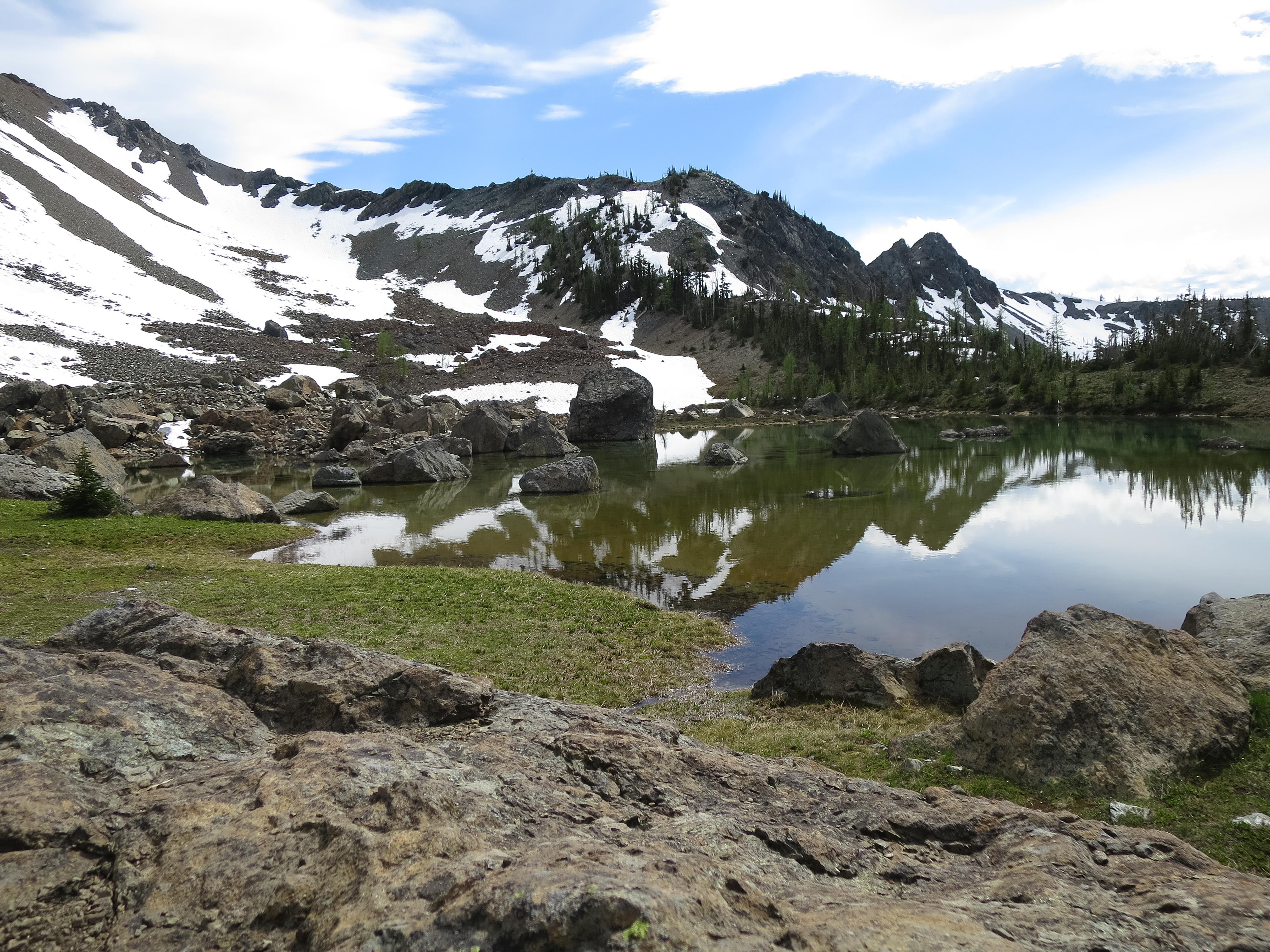
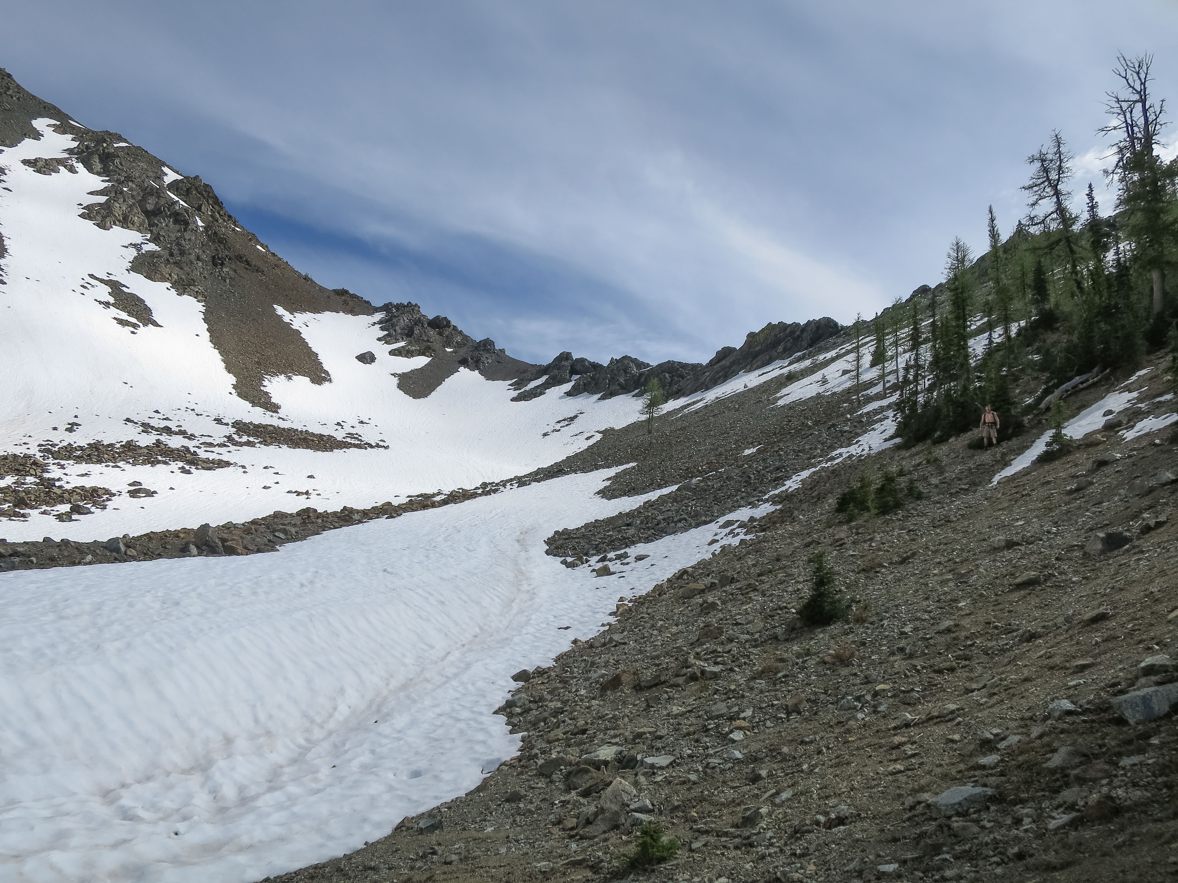
The trail was completely snow free until we got to the Lake Ann lookout. From there down to the lake there are still a few small snowfields to cross. While the amount of snow looked negligible, it turns out that the steep hillside under them is actually pretty treacherous right now, as the scree slope they sit on is supersaturated with snowmelt. As I stepped to the edge of the second small snowfield, the ground beneath it suddenly liquified, and I had the strong sense that while an avalanche was unlikely, a mudslide was quite probable, and it was a scary moment. We backtracked maybe 50 yards and opted to scramble down a snow-free patch through the trees instead, and while this way is steep and there is a lot of loose scree, it was far more solid than the actual trail at this point. I imagine that with just a few more sunny days, though, the snow will be completely gone from the trail. Once we got down to the lake we enjoyed our lunch and the squeal of marmots.
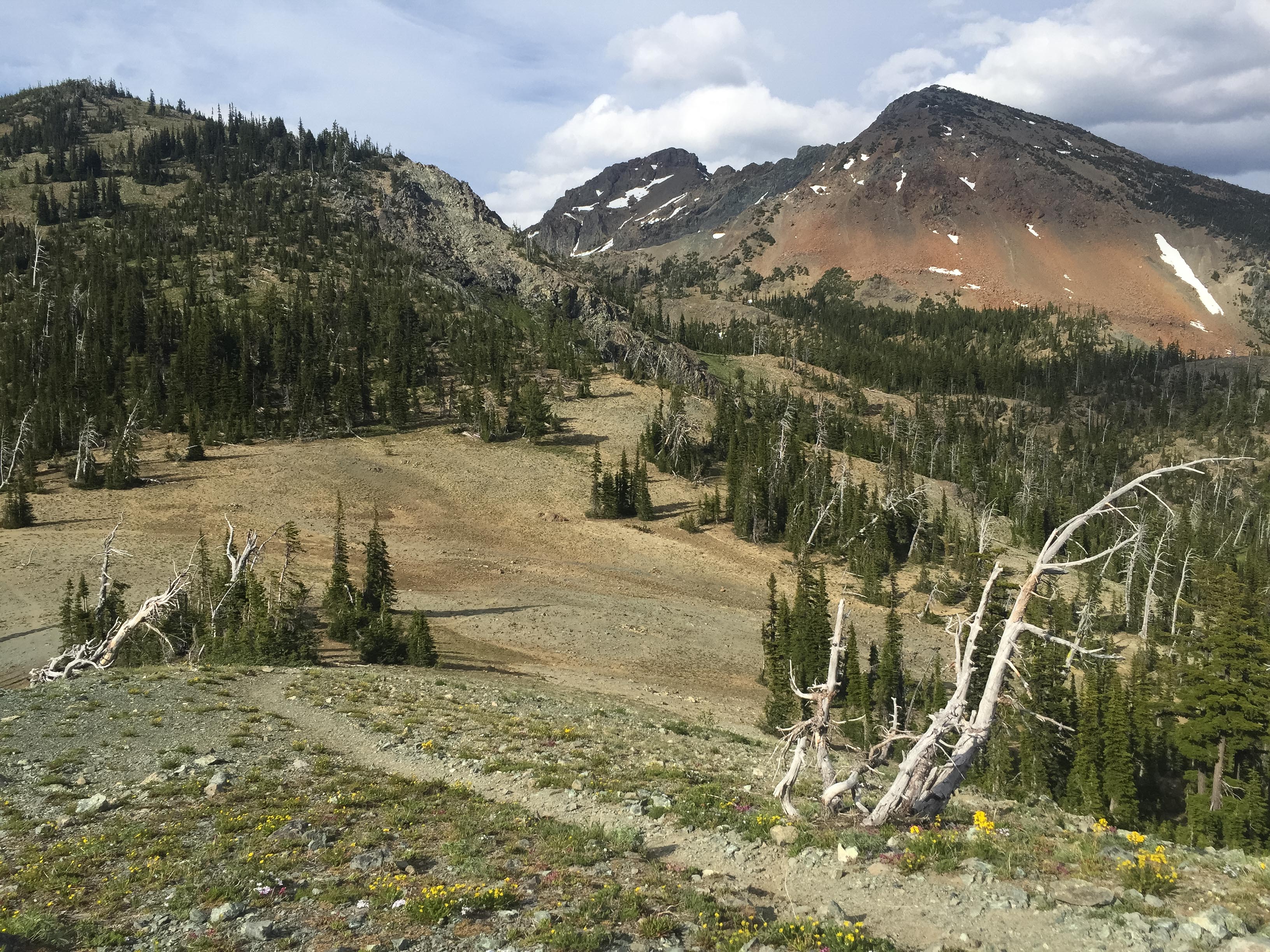
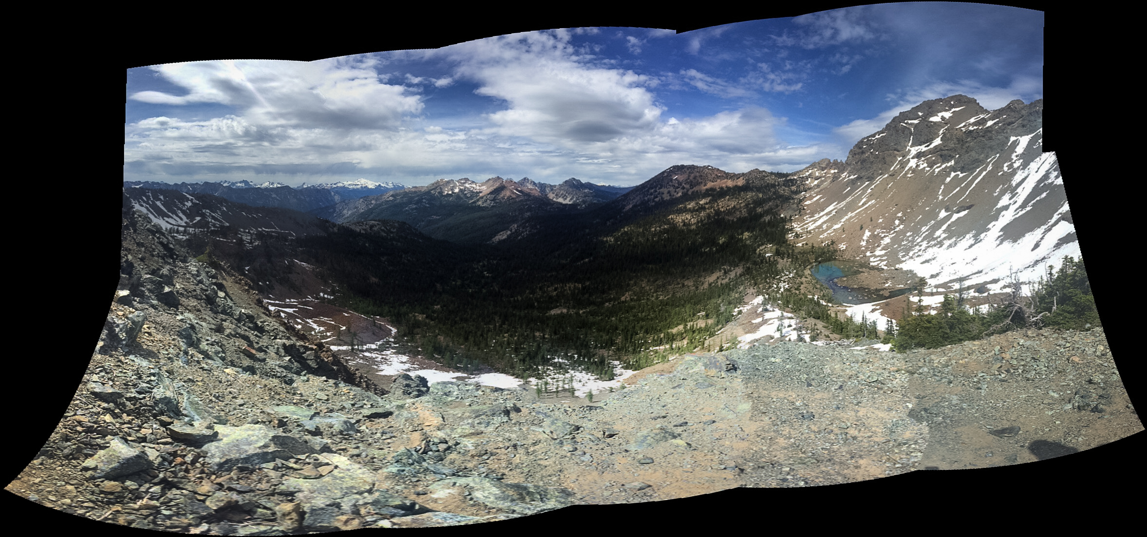
Although Esmeralda Basin by itself is a perfectly worthy hike (sweeping views of breathtaking scenery,) it’s worth the extra couple of miles to visit Lake Ann. The Lake Ann lookout gives views down two valleys, and it’s only about a 300 foot drop to go down to the lake. Then if you follow the Esmeralda Basin trail to Fortune Creek Pass, too (at most a half-mile further past the cutoff for the Lake Ann), you get to look down into a third valley. This hike packs a lot of variety and views of some rugged and impressive country, especially given that it’s fairly moderate.
The day was partly cloudy, warm, and pretty. The hike is exposed to the sun in a lot of areas, so it was nice to hike it on a day with some clouds, as I image it’s quite hot up here on a fully sunny day. That exposure means that the hike has incredible views for nearly the entire length of it, though.
Our entire trip ended up being 8.6 miles and ~2700 feet total elevation gain. Most of that elevation is in the last mile or so on the way up to Lake Ann. Otherwise, it’s just a nice, gradual climb of easy, long switchbacks; easy on the legs on both the way up and the way down.
Both the road and trail conditions are fine. Although it’s 10 miles of gravel road, it is well-maintained and should be suitable for most cars. Also, despite it being a beautiful sunday, we saw very few hikers on this trail. Most of the cars in the parking lot must have opted for the more popular Lake Ingalls.
(From my trip report on WTA.org)
More photos at Flickr:Playapixie
GPS track at Garmin Adventures

I love the Teanaway! It has been a couple years since I explored there. For some reason Lake Ann isn’t ringing a bell, but it looks wonderful.
LikeLiked by 1 person